Prut-Barlad
Watershed Area
Prut-Barlad Watershed Area is located to the North-Eastern end of the Danube basin and adjoins Tisa basin to the North-West, Siret Basin to the West and Nistru basin to the North and East. The total area of Prut basin (28,396 km²) occupies the territory of three countries: Ukraine (8,241 km²), Romania (10,990 km²) and the Republic of Moldova (9,165 km²), and the total area of Barlad basin is of 7,220 km².


Where is it located?
The second tributary, in terms of length, of the Danube, Prut River (952.9 km), forms the border between Romania and Ukraine over a distance of 31 km and between Romania and the Republic of Moldova over a distance of 711 km. Barlad River, a left tributary of Siret, is delineated to the North-East and East by Prut River Basin. Prut – Barlad Watershed Area is managed by Prut – Barlad River Basin Administration as follows: the watershed area made up of the middle and lower basin of Prut river, Barlad River Basin and left tributaries of Siret river in the counties of Botosani and Galati, having a total area of 20,267 kmp.
Relief of the river basin
The relief of Prut – Barlad Watershed Area belongs to Moldavian Plateau and to the North-Eastern part of the Romanian Plain. Landforms included in Prut – Barlad Watershed Area are the following: Moldavian Plain, fully located in Prut River Basin, with an average height of approx. 150 m. Sucevei Plateau, the Western boundary of Prut basin, where there is also the maximum altitude of 587 m (Dealul Mare – Tudora).
The Central Moldavian Plateau, made up of structural areas with an average height of approx. 400 m, fragmented by deep valleys (150 – 200 m). Pliocene hills (Tutovei Fells, Falciului Hills, Covurluiului Hills) with altitudes over 400 m to the North and of approx. 250 m to the South, separated by consequent valleys, 100 – 150 m deep, with slopes strongly affected by soil erosive phenomena. Tecuciului Plain and Covurluiului Plan are hilly plains, with widths of approx. 20 km to the South and heights ranging between 60 – 200 m.
Climate of the river basin
By its position to the Eastern part of the country, the Moldavian Plateau has a temperate continental climate with certain particularities. In lowlands, a steppe climate is dominant, and in highlands, a climate characteristic to forested areas. In Prut River Basin, the average multi-annual temperature is of 9°C and in Barlad River Basin is of 9.5°C.
In Prut – Barlad Watershed Area, average multi-annual precipitations vary between 400 mm and 600 mm per year. The multi-annual average of precipitations in Prut River Basin is of 550 mm. In Barlad River Basin, average multi-annual precipitations decrease from the North, where around 600 mm are recorded, to the South, where amounts of precipitations reach approximately 400 mm, the average per basin reaching around 520 mm. A feature of the climate regime of this area is also the frequent arctic air coming from the North–West and North to the Romanian Plain, most of the time accompanied by strong winds, generating a relatively cold and humid weather, with heavy snowfalls.
Total water resources
As a feature of Prut – Barlad Watershed Area, 80% of the hydrographic network includes non-permanent water courses, of which 60% are temporary courses (in the higher course, there is the depletion phenomenon due to periods without precipitations) and 18% are semi-permanent courses, the runoff being recorded only during periods with precipitations.
Prut River is the last 1st order tributary of the Danube and joins the latter 150 km upstream the point where the Danube flows into the Black Sea. A feature of Prut River Basin is its elongated shape with an average width of approx. 30 km. River basins of the 248 coded tributaries have the same high degree of elongation and orientation parallel to the Carpathians. On the right side, Prut river receives 27 tributaries among which we mention: Volovat, Baseu, Jijia, Elan and Chineja. On the left side, Prut river receives 32 tributaries among which we mention: Telenaia, Larga, Vilia, Lopatnic, Racovetul, Ciugurul, Kamenka, Garla Mare, Frasinul, Mirnova (in Ukraine and in the Republic of Moldova).
Barlad river, the largest left tributary of Siret, has a catchment with an area of 7,220 sq. km, with a length of the coded hydrographic network of 2,565 km. Barlad river has 42 tributaries, among which the most important are: Racova, Vaslui, Crasna, Tutova and Berheci.


Description of existing flood protection works
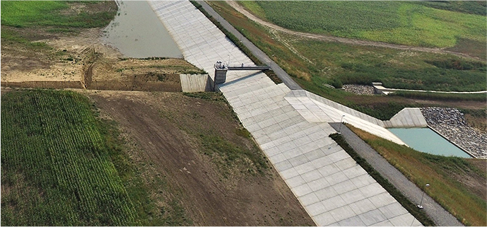
On the area of the two river basins, Prut-Barlad River Basin Administration manages waters belonging to the public domain of the State and the water management infrastructure made up of reservoirs, flood protection dikes, canals, inter-basin deviations, water intakes and other specific works.
Prut-Barlad River Basin Administration manages: 52 reservoirs with a total volume of 707 mil. cubic meters, of which 11 non-permanent reservoirs; 1,073 km dikes for the protection of localities and agricultural lands; 854 km river regularizations and 71 km bank reinforcement works; 11 pumping stations with an installed discharge of 20,946 cubic meters; 2 hydrotechnical nodes with a total discharge of 206 cubic meters/s; 6 deviations with a total discharge of 13.8 cubic meters/s and a length of water delivery canals of de 40.9 km.
Floods records
Major historical floods occurred in Prut – Barlad Watershed Area are those recorded in: 1965 (May), 1969 (July), 1985 (June), 1988 (June), 1991 (August). As a result of maximum precipitations recorded, there were flash floods leading to exceptional increases in discharges on the main water courses: Prut, Jijia, Bahlui and Barlad, as well as on their tributaries.
Maximum discharges recorded in various sectors of these water courses during the aforementioned flash floods are the following:
- 1965: 2240 cubic meters/on Prut river in Radauti – Prut, approx. 200 cubic meters/s on Barlad river in Negresti, Vaslui and Barlad;
- 1969: 731 cubic meters /s on Prut river in Radauti – Prut, 394 cubic meters /s on Jijia river in Todireni, approx. 300 mc/s on Barlad river in Negresti and Vaslui and 380 cubic meters /s in Tecuci;
- 1985: 1250 cubic meters /s on Prut river in Radauti – Prut, 212 cubic meters /s on Jijia river in Todireni, approx. 390 cubic meters /s on Barlad river in Negresti and 250 cubic meters /s in Vaslui;
- 1988: 1780 cubic meters /s on Prut river in Radauti – Prut, 104 cubic meters /s on Jijia river in Victoria;
- 1991: 1050 cubic meters /s in May and 633 cubic meters /s on Prut river in Radauti – Prut, approx. 200 cubic meters /s on Barlad river in Vaslui and Tecuci.
The flash flood occurred on Prut river, in June – July 2010, reached, in Radauti – Prut, a maximum discharge of 2137 cubic meters/s routing downstream. The flooding led to level rising in Stanca – Costesti reservoir and to the storage of a volume of water in the lake of 1170 mil cubic meters.
Among the most common floods, we mention those occurred in: 1970, 1991, 1998, 2005, 2008 and 2010.

Contact Prut-Barlad RBA
Address: str. Theodor Vascauteanu nr.10, Iasi
Phone: 0232/218192; Fax:0232/213884
E-mail: dispecer@dap.rowater.ro
Website: ABA Prut-Bârlad
 Weather Warnings