Siret River Basin
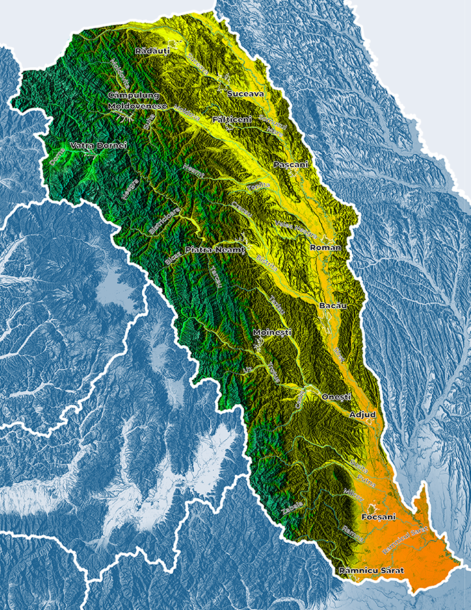
Siret River Basin is located to the East, North-Eastern part of the country, bordering to the West on Somes-Tisa, Mures and Olt basins, to the South on Ialomita – Buzau basins, and to the East on Prut basin.


Where is it located?
Relief of the river basin
The relief includes: the Eastern Carpathians, the Moldavian and Curvature Sub-Carpathians, the Central Moldavian Plateau and the Lower Siret Plain to the South and East of the watershed area. The mountainous area includes the Eastern Carpathians, with the maximum altitude in Rodnei Mountains (2305 m in Pietrosul summit). The Sub-Carpathians stretch to the East of Flisului Mountains and are made up of a sequence of flatlands delineated to the East by anticline heights of 700 – 1000 m.
The Moldavian Plateau occupies a relatively significant part of Siret watershed area (30%) and features a hilly and plateau relief with heights varying between 700 – 400 m. The plain area has altitudes ranging between 300-250 m, to the limit of the Sub-Carpathians and 20 -10 m in the Lower Siret Floodplain.
The land use in Siret watershed area is influenced both by physical and geographic conditions and by anthropic factors and has the following distribution: 58.29% forests, 22.7% agricultural area, 6.17% lands occupied by constructions and 0.67% wetlands area, etc.
Climate of the river basin
Average multi-annual precipitations decrease in the high alpine area towards the plain area and even towards the valleys in the same regions, as well as from East to West. Average multi-annual temperatures increase while altitude from North to South decreases.
Total water resources
The total area of Siret watershed area is of 28,116 sq. km, representing a ratio of 11.8% from the country area. The hydrographic network includes a number of 735 surveyed water courses with a total length of 10,280 km and an average density of 0.36 km/sq. km. On the Romanian territory, Siret watershed area includes the sub-basins: Suceava with 34 coded tributaries, Moldova with 50 coded tributaries, Bistrita with 72 coded tributaries, Trotus with 41 coded tributaries, Putna with 19 coded tributaries, Ramnicu Sarat with 10 coded tributaries and Hantesti, Somuzul Mic, Soci and Carecna (without tributaries).
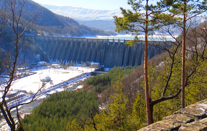
The total surface water resources in the Siret hydrographic area amounts to about 6,868 million cubic meters / year, of which the usable resources are approx. 2,655 mil.mc/an. These represent approx. 38.6% of the total resources and are formed mainly by the rivers: Siret, Moldova, Bistrița, Trotuș and their tributaries. In the Siret hydrographic space there are 21 important accumulation lakes (with an area of more than 0.5 km2), which have a complex use and amount to a useful volume of 1,206.121 million square meters.
In the Siret hydrographic area, the underground resources are estimated at 700 million meters (usable resource), of which 578 million meters come from groundwater sources and 122 million meters from deep sources.


Description of existing flood protection works
As main flood protection works in Siret watershed area, managed by the „Romanian Waters” National Administration, there are 374.52 km of dikes, 438 km of riverbed regularizations and 195 km bank defense works.
Floods records
The most important maximum discharges recorded during the period of running the program for observations and measurements in the main gauge stations in Siret watershed area (the first 4 values) are shown in the table below:
| River | Gauge Stations | Maximum annual discharges occurred (cubic meters/s) / year | |||
|---|---|---|---|---|---|
| Siret | Siret | 1193/1969 | 847/1970 | 828/1978 | 920/2008 |
| Siret | Huţani | 866/1969 | 776/1970 | 676/1985 | 813/2008 |
| Suceava | Iţcani | 1354/1959 | 1200/1974 | 720/2005 | 1710/2008 |
| Siret | Lespezi | 1133/1969 | 1080/1974 | 1028/1978 | 2414/2008 |
| Moldiva | Roman | 1140/1955 | 890/1985 | 1415/1991 | 1188/2008 |
| Siret | Drăgeşti | 1900/1969 | 1768/1991 | 1949/2005 | 2930/2008 |
| Bistriţa | Frumosu | 772/1970 | 703/1974 | 452/1978 | 471/1985 |
| Bistriţa | Frunzeni | 704/1979 | 848/1991 | 880/1997 | 1205/2005 |
| Siret | Adjudu Vechi | 2220/1969 | 1960/1975 | 2450/1991 | 2300/2005 |
| Trotuş | Vrânceni | 1193/1667/1960 | 1700/1975 | 1510/1988 | 2845/2005 |
| Putna | Boţârlău | 1000/1970 | 664/1981 | 1958/2005 | 858/2007 |
| Siret | Lungoci | 2670/1969 | 3186/1970 | 3270/1991 | 4650/2005 |
| Rm. Sărat | Tătaru | 282/1966 | 266/1969 | 274/1970 | 126/2005 |
From the analysis of maximum discharges occurred during the monitored period, a high variability of values in time and space is noted. On small rivers, where there are local flash floods caused by convectional rainfalls, dates on which maximum discharges and floods occur are extremely different.
The experience acquired in time leads to the conclusion that more general flash floods usually occur in the context of a retrograde atmospheric circulation of air masses re-taking up moisture above the Black Sea.
Contact Siret RBA
Address: Str. Cuza Voda Nr. 1, cod 600274, Bacau, Romania
Phone: 0234-541646
Fax: 0234-510050; 0234-515797
Dispatcher’s Office: 0234-515466
Email: dispecer@das.rowater.ro
 Weather Warnings
